
Meet us at MILIPOL - Paris (18 > 21 NOV 2025) #Sentinel #Milipol #HVM.

Meet us at Salon des Maires - Paris (19 > 21 NOV 2024) #Sentinel #SMCL #HVM #iPROTECT

Meet us at International Security Expo - London – ISE 2024 (24 > 25 SEPT 2024) #SENTINEL #HVM #iPROTECT #ISE_Expo @ISE_Expo

Meet us at Intertraffic - Amsterdam (16 > 19 APR 2024) #Sentinel #HVM #iPROTECT #Intertraffic
Sentinel
Map your security
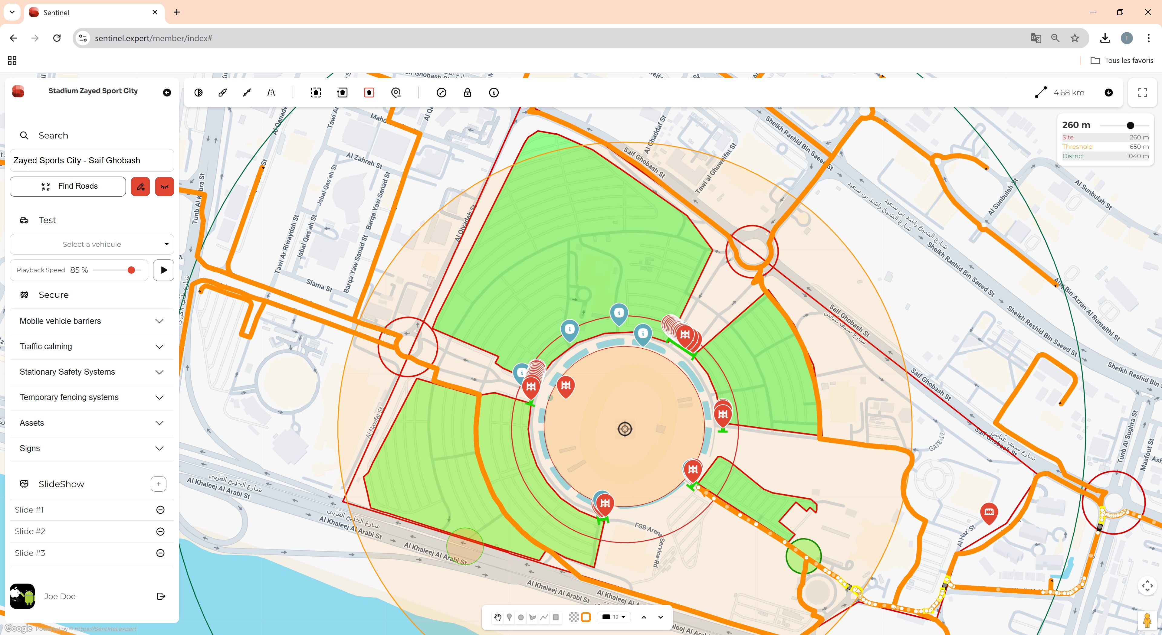
Sentinel is a software designed to organize the security of a public place and prevent vehicle ramming attacks used by terrorists. It is based on a geographical map where the user can place movable equipment and measure the speeds reached by hostile vehicles.
Discover Sentinel
Sentinel can protect multiple areas
 Specific road
 Cities
 Market
 Stadium
 Funfair
and others
Copywrite: Consel Group AG
What's the use?
The use of vehicles as weapons in terrorist attacks has been a concern, and vehicle ramming attacks can have a devastating impact in crowded places with low levels of visible security. Sentinel aims to address this threat by providing a tool for security professional and event organizations to plan and implement measures to mitigate the risk of vehicle ramming attacks.
How it works ?
By utilizing a geographical map, users can strategically position movable equipment, such as barriers or obstacles, in order to create a secure environment. The software allows users to measure the speeds reached by vehicles, helping them assess the potential threat and plan appropriate countermeasures.
It's important to note that a mitigation strategy for vehicle ramming attacks cannot be a one-size-fits-all approach. Each location has its own unique physical constraints and functional demands that need to be considered when designing security measures. Sentinel aims to provide a flexible and customizable solution that can be tailored to the specific needs of a given location.
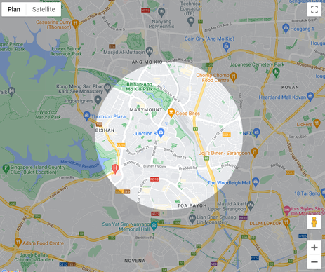
Search a place to secure
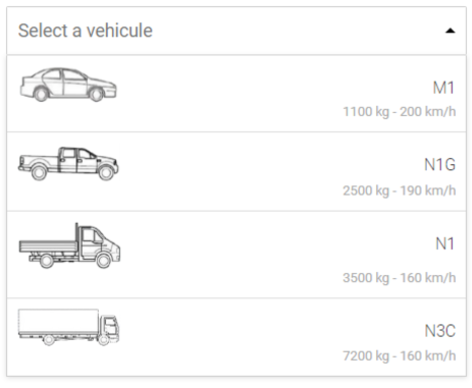
Select a vehicle
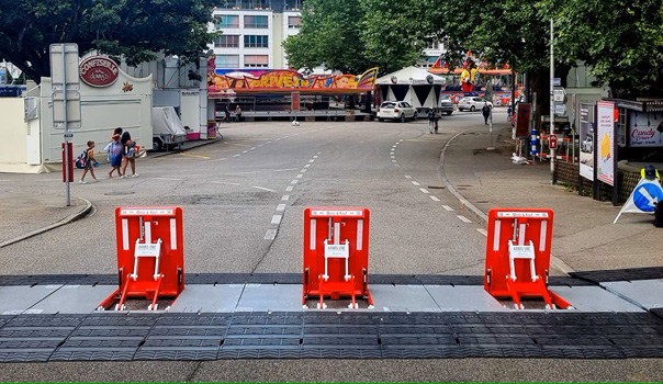
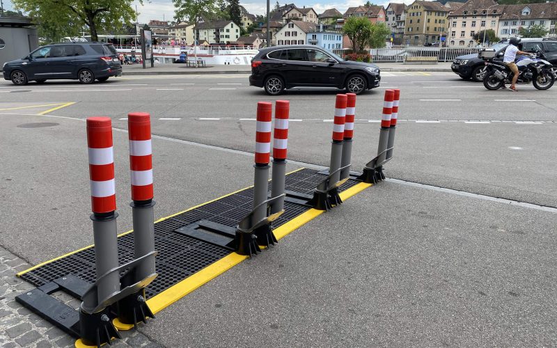
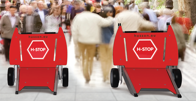
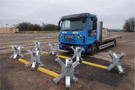
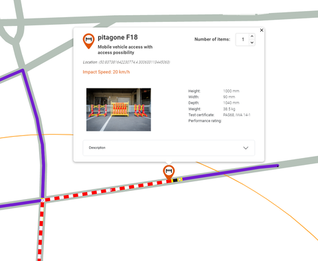
Place barriers or obstacles


PAS 69
PAS 170


© SENTINEL 2025 - Product of digi-work.com